Saturday, August 6, 2016

Cruised along the southern shore of Lake Erie to Erie Pennsylvania, anchoring in Presque Bay and took our dinghy into the town.


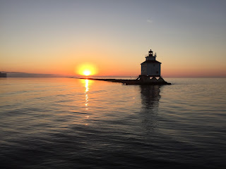
After a couple of days we moved on the Asatabula, Ohio.  We just got anchored in the harbor, when the US Coast Guard boarded our boat.  They were onboard 25-30 minutes checking documentation, fire extinguishers, life jackets, flares, navigation books, etc.  We passed - so celebrated with a glass of wine as the sun went down over the harbor and lighthouse.


The next night we were in Cleveland and spent the night in a yacht club with a view of the skyline,
We then spent 4 days cruising and exploring the "Erie Islands"  :  North, Middle, and South Bass, Kelleys Island, East and West Bay, and Cedar Point in Sandusky. 
Put-in-Bay on South Bass Island was named after the War of 1812 when Commodore Perry's fleet defeated the British Navy.  When his troops asked what to do with the Britsh - he responded " put them in the bay".   A monument to commerate him stands near the town.  Today the town is filled with tourists arriving by boat or ferry.  The streets are lines with golf carts as that is how everyone gets around.


Cedar Point is a large penninsula connected to Sandusky, and the home of a very large amusement park on the water.  Somehow - we ended up on "Millennium Force"  the "best steel roller coaster in the world" 
 Where's Waldo? - - um our boat??


Mayday, Mayday, Mayday!
It was a 3.5 hour cruise across Lake Erie from South Bass Island to Monroe, Michigan.  When we arrived we encountered a 1,000 foot container freighter in the middle of the channel.  As it turned out the freighter was backing out of the channel as it was dragging on the bottom.  As we were attempting to navigate around the freighter, the Coast Guard broadcast a Mayday.  Normally they include a GPS location and protocol is to log that position and ours to identify proximity.  This however did not originate from a VHF radio, but a 911 call on a cell phone - so we heard "woman overboard at the mouth of the Raisen River".  I looked at Walt and said - isn't that where we are going?  Confirmed by the chart I grabbed the binocculars and started looking once we were around the freighter.  I saw 2 boats in the vicinity - one they were clearly fishing - the other did not appear to have anyone aboard.  We headed for the boat.  On the way we found two red cushions floating and dropped a man overboard marker in case someone had let go at that point.  When we got closer - we saw it was a pontoon boat, a man was on his stomach laying on the floor, trying to keep a woman in the water afloat.  I first threw a rope - but realized she would not be able to hold on to it - so went to the back and threw a life ring. Walt got close with the boat and we were able to get her over to our swim platform but she was took weak to climb the stairs.  I held her up by her lifejacket until Walt got a lifejacket on and jumped in the water.  The two of us were then able to pull her aboard.  By this time the Coast Guard had identified our position by AIS and asked if we could assist.  We told them we were already at the scene.  First a local sheriff boat with EMS aboard arrived - but she refused medical treatment.  The pontoon took off before the Coast Guard arrived, but the Coast Guard did catch up with them up the river.  It was quite an experience - and we were grateful for a good outcome. 

We have now left Lake Erie and are working our way back to Lake Huron.  We are going up the Detroit River, past Detroit Michigan into St. Clair Lake.  Along the shore of the lake is "Nautical Mile"  which boasts the largest concentration of boats in the midwest - with one marina after another,  and I think most of them were out boating today!  Tonight we are in Port Huron and will head out to the Great Lake tomorrow.


Tuesday, July 26, 2016

We left the Trent -Sevren Waterway, crossing over the Bay of Quinte, and headed down the Murray Canal.  Boat traffic on the canal is monitored closely and there is a swing bridge on each end.  Because it was windy - we called ahead to have the bridge opened, only to be told that "it will be 20 minutes because the guy is at lunch".  So - along with a couple of other boats, we floated waiting for lunch to end.  At the other end of the canal, when the bridge opened, we were told in what order we could pass through - because a man was waiting with his pole to collect $5 from each boat.


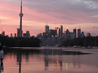
We traveled the coast of Lake Ontario - to Toronto.  It was fun to watch the skyline take shape as we cruised in.  We found a great place for the boat at the Toronto Islands in the Inner Harbor.  It was on a wall next to a park and we had a stunning view of the skyline from our aft deck - especially pretty at night!

We took a ferry into the city and spent a day walking and exploring.  The next day we biked around the group of islands - collectively called the Toronto Islands -  all connected by bridges, and stopped to swim in Lake Ontario.  Center Island has a botanical garden, wading pools, amusement park for kids, boat and bike rentals, restaurants, bars, etc.  There were several beaches - including a "clothes optional" one. 

Although we loved Toronto - with a good weather forecast we decided to make our crossing to Port Weller which is next to the Welland Canal.  From the marina, we biked to Niagara Falls.  We had to cross through "Niagara on the Lake", which was Canadian version of Napa Valley, with mile after mile of wineries, and groves of peaches, and plums.  Then began the 300' climb up the Niagara escarpment.  It was a very hot and humid day.  The beginning of the bike trail was very pleasant through parks and along the Niagara River, but before long - the trail led to busy streets - or bumpy sidewalks crossing back and forth across the busy streets.  We weren't sure we could make it - but we FINALLY did.


The falls were impressive, but the surrounding area was very commercialized with souvenir shops, fast food, casino, motels, etc. which distracted from the natural beauty.  We grabbed a beer - and then a cab - to get us back to the marina ;)

I would have liked to spend another day at Niagara on the Lake, but we had already arranged for a deck hand for the Welland Canal - so had to leave the next day,

The Welland Canal - 26 nautical miles - 3 bridges & 8 locks.  The canal has dual locks so there is upbound as well as downbound traffic.  Locks 1, 2, 3 and 7 were single with 45 foot lifts.  Locks 4,5,6 was a "flight" of locks - leaving one, you enter the next.  The primary purpose of the Welland Canal is to accomodate commercial traffic.  Pleasure craft must be at least 20 feet long, and weigh 1 ton.  Those locking down can do so with 2 adults on board, but if you plan to lock-up (as we did) 3 adults were required - so we had to hire a deck hand.  "Norm" met us at the entrance at 7am, and we called in - to announce our desire to transit the canal.  We had been told that we could wait 2-8 hours, and sometimes pleasure craft have to come back the next day - if the commercial traffic is heavy.  Unlike the other locks we have gone through - this 766 foot lock was not going to fill up with 21 million gallons of water for one or two pleasure boats!  There was a 32 foot sailboat waiting with us.  We got lucky, because after one hour - our "lock mate" for the day showed up - - a 200 foot yacht called "Rock.it"  (rumor was that it belonged to the owner of Jimmy John's)  


After our hour of waiting, it took us 9.5 hours to move through the locks.  We could not have done it without Norm - as Walt had to stay at the helm with the engine running to maintain position, and we needed to constantly work the lines to stay by the wall.  The turbulance was bad and required constant attention to bow and stern lines - even though the yacht had requested a "slow fill".  We managed fine because of our thrusters, but the sailboat was really tossed around and the line handlers were holding on for dear life!


 Norm jumped off after the 7th lock - as the 8th lock only lifted 4 feet and we did not have to catch a line because by the time we crossed the lock - it was full and the gate opened.

We spent a night at a marina in Port Colborne, but then decided to move back to the canal and watch some of the traffic.  Walt started a conversation with one of the pilots - and the next thing I knew - he was making runs with them.


Unless a captain has experience going through the locks "x" number of times - they are required to have a pilot aboard - both locking up and locking down.  So there is a "pilot boat" at each end of the canal - and they pull alongside the large vessels, jump aboard, guide the captain through the canal, then jump back on their boat at the end. 

Today - we are back in the USA!!  Cleared customs in Dunkirk, New York.  Canada was great and the people were friendly - but it's good to be home!


Sunday, July 17, 2016

You never know who you are going to run into when traveling.  One night we went into a marina and in the boat next to us was a couple from White Bear Lake.  Halfway through the waterway we were tying up to a wall awaiting the lock opening when a guy shouted "Weren't you at the Washburn Marina last year at this time?"  We were there for 2 weeks getting repairs and met them as they were planning their trip - and now - they were headed back home.  We have seen boats from Florida, Michigan,  and California.  At one lock we met a Russian guy who was trying to negotiate with us for a spot along the wall to tie up.

We have now traveled over 1,000 miles and completed the Trent-Severn Waterway with it's 42 locks.  The most memorable were :
Lock #44 - the Big Chute  The lock tender uses a loud speaker to guide boats in, floating over slings which pick up your boat.  The chute then moves on rails across land - up or down 58 feet while you sit on the bow with the boat rocking back and forth.  When the next level was reached, we were submerged in the water until we floated off the slings.


Kirkfield Lock #36 and Peterborough Lock # 21
Peterborough is the highest hydraulic lift lock in the world at 65 feet and Kirkfield is the second highest at 49 feet.  Both locks are side by side "pans" of water.  To operate, one foot of water is allowed to run into the top pan which by gravity causes it to sink and the lower pan to rise - in about 2 minutes time!   The Kirkfield lock was not enclosed - so we could watch ourselves rise high above the tree tops ( 5 stories ).  In the Peterborough Lock - we were locking down - so drove the boat into a pan of water that looked like an infinity pool and you felt as if you could drive right over the edge.  There were spectacular views both rising and lowering.


Typically, most of the locks had swinging bridges which would open when the lock was open.  
And - although some were hydraulic - most were hand operated.
When it gets real hot the lock tenders are required to take a 30 minute break every 4 hours - so the lock may close temporarily.   Some locks were miles apart and some were only 0.25 - 0.5mi apart.  Two locks were tandem, so when you left one - you were entering the second.

The Trent Severn is a series of canals - some man made - like McDonald's cut - all done by hand in 1905


and includes lakes.  The channels were often so narrow - I could reach out and touch the tree leaves as we passed. They were often shallow and more than once we felt our bottom dragging.  There was also lot of weeds which would give us erroneous depth readings on our depth sounder.  And - bridges were a concern.  We never had to drop the mast, but most bridges Walt would climb to the top to make sure we would clear.  One interesting bridge - built in 1905 was called the "Hole in the Wall".
The highest point on the waterway is Balsam Lake.  It is 840 feet above sea level - and is the highest point in the world that a boat can reach from the sea under its own power.  From Lake Huron, we locked up to Balsam Lake and then locked down to Lake Ontario.


The waterway started out looking like a resort area with many small cabins on the waterfront, jet ski's boats, etc.
Then turned into farmland
And ended up marshland
And in between was many narrow, winding passages - like this through "Hell's Gate"
Most of our nights we spent "tied up" at the lock.  Some had small towns nearby that we could walk to.

Tomorrow we head for Toronto, Niagara Falls and the Welland Canal.


Friday, July 8, 2016

Friday, July 1    Canada Day - and they love their flags!


We have now completed Georgian Bay and it's 30,000 islands.  We feel a real sense of accomplishment.  Although it was beautiful topography - navigation was very stressful, as we passed through numerous channels no wider than the boat and solid granite boulders on both sides.  These channels required a "securite" call to alert other boaters as it would be impossible to meet & pass.  We followed the "small craft route" - but when it intersected the shipping lanes, buoy color would change - red on left to red on right,  Thankfully, the water level on Lake Huron is up - 0.88 meters above chart datum - as our depth in some channels went as low as 5' 8" and we have a 4' 10" draft.  We had to go out in the bay to bypass two channels - "Hangdog" and "Canoe" because it was impossible for vessels greater than 40 feet to make the hairpin turns required to stay in the channel. 
We had Canadian strip charts and I marked off each bouy, rock marker, etc.  as we passed.  Several times we had to stop as we were unsure of the route and there was absolutely no room for error! Navigation was like playing a video maze game which required the constant attention of both of us.

Now seeing lots of other boats of all sizes and types.  Also seeing lots of stunning, upscale homes built on cliffs overlooking the water.  The houses are often estates with guest homes and elaborate boat houses.  Appear to be more than summer homes - but not near any towns and often built on islands so not sure what they do in the winter, or how kids get to school, etc.  Construction is handled through boats and we see many of them carrying shingles, insulation, etc. which have been loaded off docks from barges.

Saturday July 2 -  Beginning of Georgian Bay thru the Collins Inlet -

to Mill Lake, Beaverstone Bay, out into the Bay, and around the Chicken Islands to anchor in the Bustard Islands.

Sunday July 3 - Followed the Northeast Passage thru Dead Island Channel, around Bigsby Island, past the Churchill Islands, and into Rogers Gut,


ending at Britt in the Byng Inlet.

Monday, July 4  Headed down South Channel around Duffy Island then out to sea around the Norgate Rocks and returned via Point Au Baril -
It was 6 miles up the channel to the town.  Hundreds of small motor boats were in the channel.  The "towns" seem to be composed of 1 store which serves as the marina, grocery, liquor, hardware and sometimes restaurant.  We tied to the town dock, but our night was disturbed when a Canadian Coast Guard barge tied up next to us and ran their generator all night.

Tuesday July 5  Middle Channel, Shawanaga Inlet, north of Twin Sisters Island, east thru Shebesherong Channel by Narrows Island to Snug Harbor.
Wednesday, July 6   The small craft route split and we chose to go north to Parry Sound where we stopped for lunch then traveled on through Two Mile Narrows, Three Mile Gap, Five Mile Narrows, and Seven Mile Narrows,

ending in Kineras Bay.

Thursday, July 7  Through Devil's Elbow


down the South Channel to Frying Pan Island, where we stopped for lunch.  When we left a fog bank rolled in.  We turned on our radar but because we were surrounded by so many islands - and because we were constantly changing directions, it was difficult to pick up other boats.  After 2 or 3 boats "popped up" about 50 - 100 feet from us, we decided that navigation, radar, chart plotting and driving - was too much for 2 of us - so we turned back and anchored in a bay.  


Two hours later the fog lifted.  There was no doubt that we had made the right decision as we then traversed one of the most difficult areas around O'Donnell Point with several S shaped turns to avoid the rocks. That evening we anchored in Indian Harbour.
Friday, July 8  Out to the bay around Galbrath and Splitrock, north of the Valentine Rocks, south of Red Rock through the Muskoka Landing Channel.  Through the Main Channel, north of Beausuleil Island.  Past Honey Harbour into the Inner Channel and Severn Sound. Last narrow channels were Potato Island Channel and Tug Channel.  We - briefly - sighed relief as we had made reservations at a marina in Port Severn and were so glad to have "made it" until we realized that our reserved marina was on the other side of the 1st  lock of the Trent Severn Waterway.  Lockmaster saw us coming - opened the swing bridge and lock doors while we scrambled to get fenders out and find our lock pass.  This is the smallest lock - and hand operated!  Marina is also a resort & spa - so - in addition to our usual re-provisioning, cleaning, laundry, etc, - we took time to enjoy the pool.
Now - on to the other 44 locks on the Trent Severn Waterway.


Friday, July 1, 2016

Saturday, June 25  In Tashereau Bay we saw blue heron, eagles and loons.

Sunday, June 26   Cruised Whaleback Channel leaving through Little Detroit Strait into the McBean Channel and then on to the Benjamin Islands.  This has been described as one of the most beautiful anchorages in the world - and - pictures do not begin to capture the beauty!


Limestone, pink and grey granite bluffs, with emerald green trees, crystal clear water.

Walking the bluffs was like being in a Japanese garden with plants and flowers growing in the rock depressions.

Monday, June 27   Headed down Waubuno Channel for a bay outside Little Current.  The bottom was weedy and we could not get the anchor to set, so we headed back out to the channel.  Waves were getting high and we picked up gusts of 30 knot winds.  Radioed 2 marinas in Little Current - but they did not have any transient slips available - so we had to backtrack up the channel and found a bay named Bell Cove on the northern shore of Great La Choche Island where we anchored for the night.

Tuesday, June 28   Stopped at Little Current.  Although this town is a port for a Canadian cruise ship which travels the North Channel and Georgian Bay, most of the shops were closed with "for sale" signs on them. 
We continued on to Baie Fine - which is the closest thing to a fjord in North America.  It is ten miles long and ends in "the Pool".  We traveled very close to the tree lined white quartz bluffs.


We took the dinghy into "the pool" as we wanted to hike to Topaz Lake in the Killarney Provencial Park - and we FINALLY found it - after 4 hours of hiking, several wrong turns, and two other lakes (Artist & Cave Lake).
Thursday, June 30 
Killarney is an interesting town - built on the waterfront of a long narrow channel that opens out to Georgian Bay.  Many of the shops have their own docks - so you can stop and shop.  We are at the Killarney Mountain Lodge & Marina two days until storms pass, but look forward to starting Georgian Bay tomorrow.
Six days ago we picked up AIS signals from "Dreamland".  The next day they followed us into the Benjamin Islands and we got a chance to meet them.  We have been following each other and meeting - all the way to Killarney - but now we will part ways.  They are from Ann Arbor, MI and traveling with a group of 11 other boats from the NY Yacht Club. 


After an evening of watching the freighters line up for the Soo Locks, and an impressive fireworks display which appeared to be coming from the Canadian side of the river, we headed down the St.Mary's River.


At the St. Joseph Channel we left the river and stopped at Richard's Landing for lunch and to again clear Canadian Customs.  The channel is unique in that it is full of many very small islands and many of them have one house on them.  We anchored for the night in Brickyard Bay on St. Joseph Island. 

Thursday June 23 - Thessalon, Ontario - a cute town and nice marina - but no one was there as it was closed until July 1st - "when the season begins"! 

Friday, June 24 - Traveled the north shore of the North Channel to Blind River.  This beautiful marina was open.  We got out our bikes to check out the published bike trails -
maybe when the season begins - it will be used more - and not so overgrown.

Tuesday, June 21, 2016


The north shore of Lake Superior is far different than the southern shore.  Two summers ago when we brought our boat from Milwaukee to the Apostle Islands, we traveled the southern shore.  It was rocky, at times mountainous, and dotted with towns (Grand Marais, Munising, Marquette) which provided the only harbors of refuge.  The north shore is miles and miles of pristine wilderness, numerous islands to cruise and many natural bays and coves in which to anchor.  Towns are rare, and although we saw several small fishing boats, a couple of dive boats, there was only one other boat our size.  "Harborlite" was captained by Chase, Nate and their wives.  Anchored in a cove behind Otter Island, we first met these two young guys when they stopped by with their fishing boat in the early evening to say hello and chat.  The next morning they were out fishing early and again stopped by our boat with a large bag of lake trout they had just cleaned!  Thirty minutes later we were navigating a narrow channel leaving the cove and a strong current put us aground.  Chase and Nate pulled up anchor on their large trawler and came to our rescue!  After securing the boat, Walt took the dinghy back to thank them and reimburse them for their time and generosity.  Not only did he return with the money they refused to take - but also had a rum & coke! 

Saturday, June 10  A beautiful sunrise as we left the harbor in Thunder Bay.

Followed the coast and anchored in cove on Edward Island.  Crystal clear water, green hue from all the surrounding pine trees.

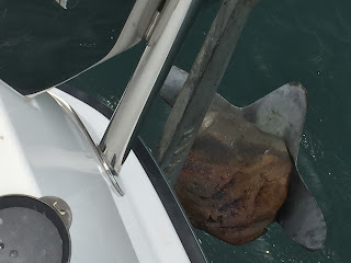
Sunday, June 11  Stopped for lunch in Loon Harbour.  When we pulled up anchor to leave, a large rock was stuck in the anchor.

Rounded Heron Point and anchored in a cove behind Otter Island - where we met Chase & Nate.
Wanted to walk to the waterfalls that we could hear, but were unable to find the path - and were unable to forge our own path.

Monday June 13  Followed Black Bay Peninsula.  North of Lamb Island was a stunning view up the Nipigon Strait.  We rounded the southern shore of St. Ignace Island, and then Simpson Island where we dropped anchor in the far end of Woodbine Harbour.  This marked our northern most point on the Great Lakes at 48 degrees, 45 minutes, and 30 seconds north latitude.  Met a couple of people from Vermont - fishing in the cove.

Tuesday, June 14   Stopped at Battle Island and walked to the lighthouse.
then headed for the Slate Islands - a group of 8 islands formed by an asteroid.  Known to be inhabited by a large herd of caribou - but we did not see one.

Wednesday, June 15    Crossed back to the mainland to Pukaskwa National Park.  Dodged floating logs entering Pulpwood Harbour.  This was once a logging area - which was evident when we later walked the beaches.
Thursday, June 16   Another beautiful day and calm seas.  Traveled down eastern shore.  Cruised by Cascade Falls, then dropped anchor in Otter Cove - behind Otter Island.


 Friday, June 17   Cruised to Michipicoten Island, and explored Quebec Harbour.  Then crossed back to the mainland and anchored in Indian Harbour off of Cape Gargantun.

Saturday, June 18   Walt's 66th birthday.  So beautiful here - decided to spend the day exploring.
Took dinghy around the cape to Warp Bay where there was a great sand beach.  On the way we passed Devil's Chair (spot where Nanigoujou, the giant who protected the Ojibwe rested after jumping over the lake)

 We found hiking trails. On the path we saw fresh moose tracks.  Deep in the woods we heard a noise, then animals came charging through the brush and began circling us, growling - not moose, wolves?? - no - 2 large dogs!!   Not soon enough - a woman emerged.  She was walking the trails by herself and said she often saw moose - heard a noise - so sent her dogs ahead to "attack".  The rest of the hike was without incident and we ended up on a bluff high above our anchorage


Sunday, June 19   Another travel day.  Wind started picking up and we pulled into Mamainstee Harbour and tied up on a dock with all the fishing tugs.


Monday, June 20   Headed out for Sault St. Marie.  As soon as we left the harbor, we were hit with 5-6 foot waves.  Unable to turn back, we planned to go into Batchawana Bay - about an hour away.  We were pitching and rolling - and so was everything on board!  After 3 hours of tacking, we made it to the bay - but suddenly the waves died down and we decided to keep going.  In Whitefish Bay, the waves started growing again, and we entered St. Mary's River with a significant following sea.  We crossed our path from 2 summers ago at the Gros Cap Light.  Last time I was driving and mistook this for a boat and set my course behind it - until I eventually realized not only was it not moving - but it was not a boat.  Walt was driving this time - and of course did not make the same mistake!


 About 2 miles from the soo locks - the wind picked up and we were getting hit with winds up to 37 knots!!  I was on the deck trying to put out fenders and the wind, waves, and water spray was so loud I could not even hear Walt on the communication set.  We did make it into the lock -


- but still had to get into a marina.  We called ahead to get help with lines.  The dock boy was unable to keep control of the stern line - and Walt came out of the pilot house to throw a line over a post.  He forgot to take his socks off and when he threw the line - his whole body went flying!!  We were a good 3 feet from the dock and I was sure he was going into the lake - but he landed on the dock in one piece.  Of course we had not cleared US Customs yet - but explained to them that he did not get off the boat - but fell off ;)

Watched a HUGE freighter go through the locks last night.  We are spending the day here - trying to catch up on things, then will head back into Canada to the North Channel.